
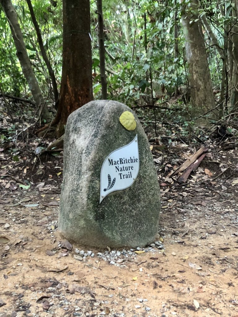
I ran the Macritchie Nature Trail loop to find out if, after the trail upgrading works, the trails have been made too easy. Two boys lost in Macritchie, sparked this three part series. Read about that and anti fragility here.
In an earlier run, I covered only a part of the loop. Read about that here. In that run I found total facelifts in some areas but there were also familiar parts. In this run, I took in the entire loop of the Macritchie Nature Trail. What I found was not what I expected.
This time, I started out at Macritchie Reservoir Park, going into the forest at the Lornie trail.
Running in from here, the trail was just that, a mud trail. A little way in though I see the boardwalk, the Chemperai trail, which I ignored. The Lornie trail was the course for school cross country races and there were no visible changes. Slopes were as slippery when wet as they were all those years ago. I loved attacking up the slopes and careening down it on the other side. Here I find sections with slippy, slidey, muddy trails, and low hanging branches. Keeping my footing and ducking to avoid slapping into branches was exhilarating, just the way I remembered. I enjoyed this stretch.


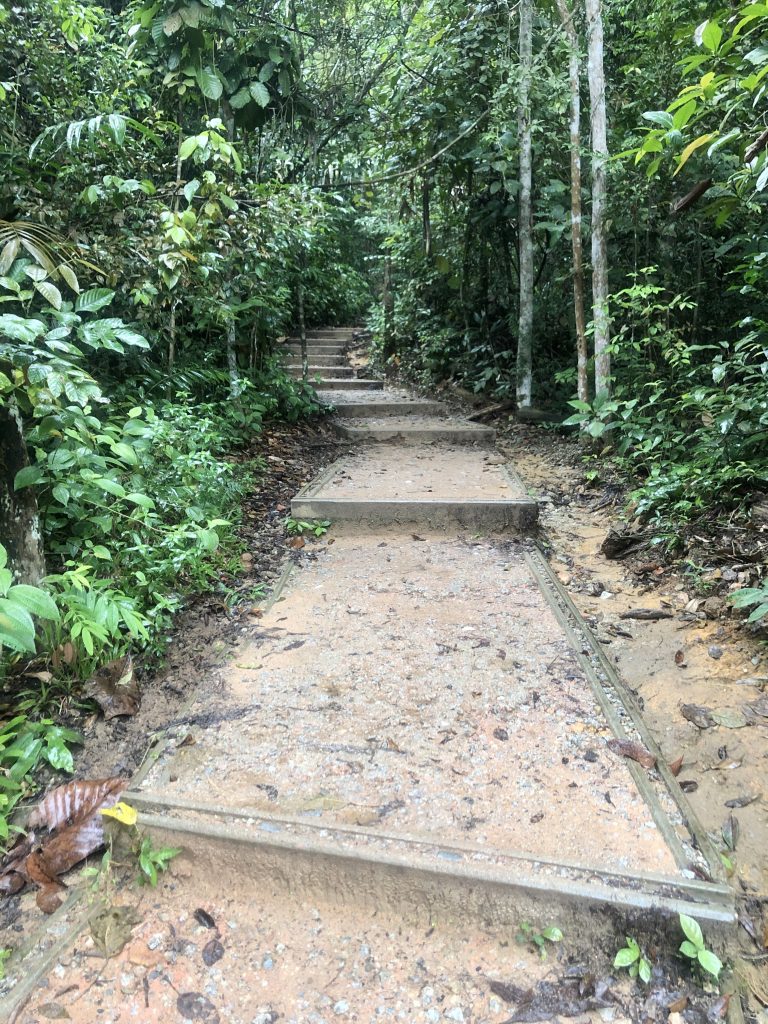
At the t junction where the trail meets Singapore Island Country Club, Bukit Location, I hung a right. Going left, would have taken me out to Lornie Road. This was where things got a little disappointing for me. The little slope I enjoyed kicking up is replaced by steps, or perhaps they are little terraces, making it easy for urban Singaporeans to traverse. Where, before one had to propionate, to keep the footing, duck under or bound over fallen branches, there is now a series of longish steps or little terraces, making the accent up the slope, a leisurely stroll. The odd shaped terraces do not inspire me to run up. So I strolled up. No challenge was to be had here, but once I have walked up the terraces, the downhill path was back to trail and mud.

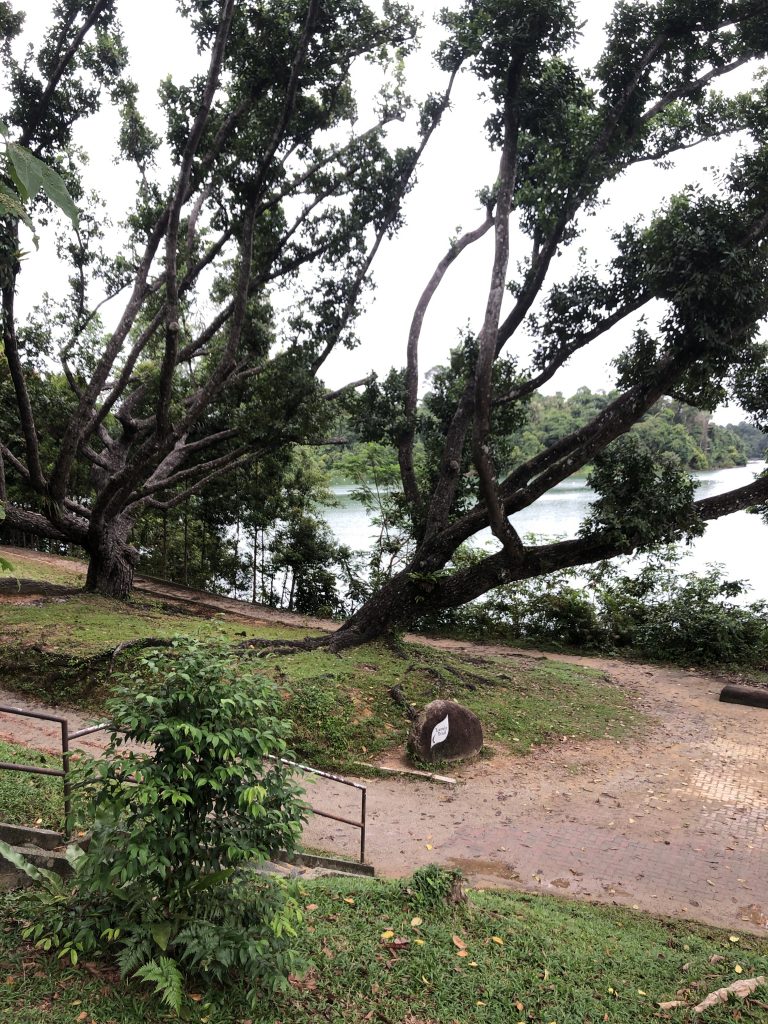
When the trail opened up to run parallel to the golf course in the west and the reservoir in the east, a copse of Malabar Melastome bushes greeted me and stayed with me on the reservoir side for a while as I ran.


Running by the water’s muddy edge with plenty of space and frontage, reminded me of a run I did in the high plains in Yunnan, though the space and sky here is minuscule in scale compared to the one in Yunnan. You do get the sense of expansive space, hardly a thing you get in urban Singapore. So this is where to get that expansive feel here.

Back into the woods, but before that, these pillars on the water, always reminds me of temple ruins, the kind Lara Croft had her adventures in. There are only ruins here, no vending machine so you need to bring a water bottle.

Past the ruins is small section of boardwalk, then back to muddy trail towards Jelutong tower.


A little ways past Jelutong tower, on the Sime track, you will find a little offshoot to the left. I have always liked this offshoot, connecting onto Rifle Range Link. Rifle Range Link will lead us to the Tree Tops Walk if we head north east or Rifle Range Road and the Pipeline if we headed south west. A stream and an old hut is the highlight for me. The hut in the water and amongst vegetation, brings images of an abandoned village. The stream, if you come across it on a sunny day, is a delightful light show. Sunlight filtering through the canopy and reflecting off the clear water of the stream is a delight to watch. You can choose to splash across and cool your feet or nimbly bounce off partly submerged stones to get across. However you choose to cross the stream, you will be rewarded with animalistic pleasure.


Upon hitting Rifle Range Link, I doubled back to Sime Track to head to the ranger station on the Terentang Trail. There are no vending machines at the ranger station, only toilets and a water cooler to fill your water bottle from.
The steep slope towards the Venus Drive carpark, where I once enjoyed kicking up, is now replaced by wide steps or little terraces. To be fair, this slope is a mite dangerous, with above ground roots, gravels that acts like marbles on a road, and holes in the ground. I twisted an ankle here on one run. But still it WAS an enjoyable ride, this slope. I remembered one TNF 100 race, when it was still dark, a lady runner was screaming with exhilaration while going down it. While the steps made the slope safer, it made the journey less enjoyable.
At the top of that slope, is the Terap Trail back to Macritchie Reservoir Park.


Tiger lilies and a Crimson Sunbird awaited at the park.
The verdict then, while there are sections that have been made easier, large sections of the trails remain challenging. I can see the idea is to make the trail easier, safer and more accessible to the public, who would not normally go out into nature. NParks’ vision is “Let’s make Singapore our City in Nature”. I think in this respect they have done well. They have brought some city to nature within the nature reserves and have brought nature to the city in the various little parks that they have built and beautify within the city.
So the answer is no, the trail is not that easy. Run the trail with me!
One thought on “Is The Macritchie Trail That Easy?”