
How many bridges span the Singapore River? Starting from the river mouth at the confluence where the river empties into the Marina Bay, I counted 20 in the 5 plus kilometres to Tanglin Road. At Tanglin Road the Singapore River ended and seem to have gone underground.
I first ran this route in 2010. What got me interested in running this route was La Seine which snakes through Paris. Back when I was a corporate warrior for a French MNC, I frequent Paris on work trips, meeting my bosses and co contributors.
On these trips, I would run in the woods of Bois de Boulogne, Bois de Vincennes and the numerous little parks that dot the city. While runs in the Bois or woods were nature centric and wonderful, meandering through the large, old trees and landscaped gardens, I also enjoyed running along the Seine.
Along the Seine, one can run on the banks, where the wharfs are and my go to route was from the Pont de Arts in the Latin Quarter of Saint Michel right up to Pont de Iena at the Tour Eiffel. These were the days when I ran sans GPS tracker, smartphones and apps like Runkeeper, all of which were science fiction at the time. I only had my Polar AXN500 a wonderful running computer of the era. I wear a heart rate monitor on my chest and a transponder on my shoes that records my stride length and cadence, hence distance.
So, no photos. It was scenic, running along the Seine and glimpsing the Lourve, the Jardin Tuilleries and finally coming face to face with the Tour Eiffel. It was 4km from Pont de Arts to Pont de Iena and I counted 10 bridges.
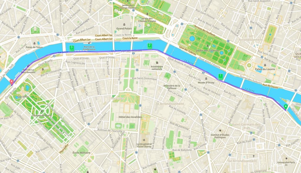
to the Tour Eiffel route
So this was the run that got me interested running along iconic rivers of a city and counting the bridges spanning them. And so it was, that I run my home river and made it one of my regular routes. I counted 20 bridges spanning our Singapore river. Only 16 are named, 4 are named as famous roads in Singapore. The unnamed 4 are at the Tanglin Road end. Beginning from Marina Bay, these are the 16 named bridges:
Jubilee bridge, Esplanade drive, Anderson, Cavanaugh, Elgin,
Coleman, Read, Ord,
Clemenceau, Alkaff, Pulau Saigon, Robertson, Jiak Kim,
Kim Seng Road, Zion Road, Delta Road.
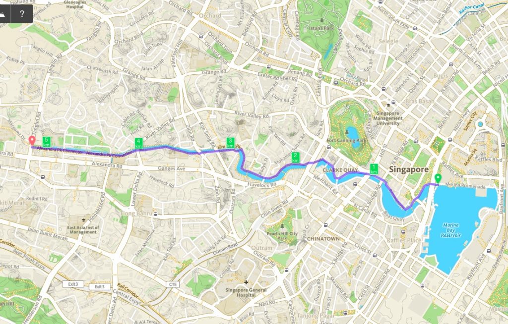
the Singapore River Bridges route
Here are some interesting things about some of these bridges. On Cavanaugh bridge, there still stand a Police Notice that prohibits access to vehicles heavier than 3 CWT. What is a CWT?
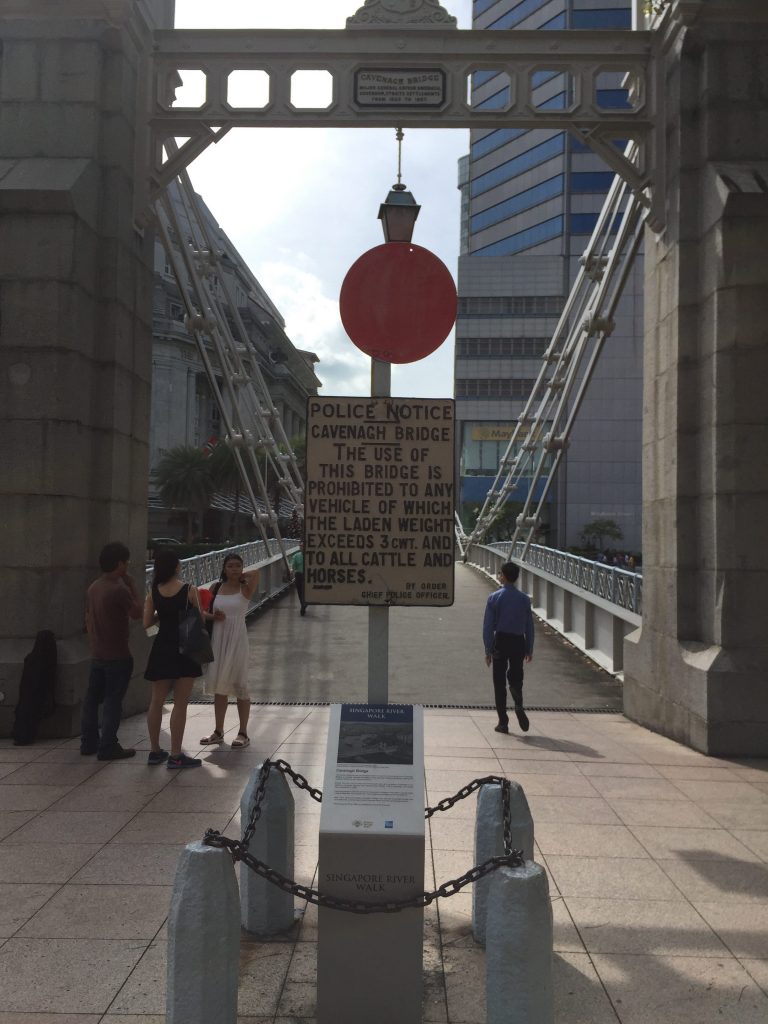
how heavy is 1 CWT?
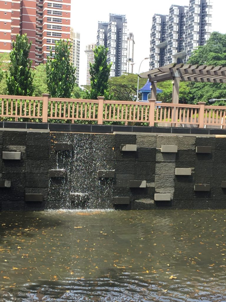
Alkaff bridge is the most colourful and there might be a mystery here. This notation “pacifa abad” was painted on the side. What does ‘pacifa abad’ mean?
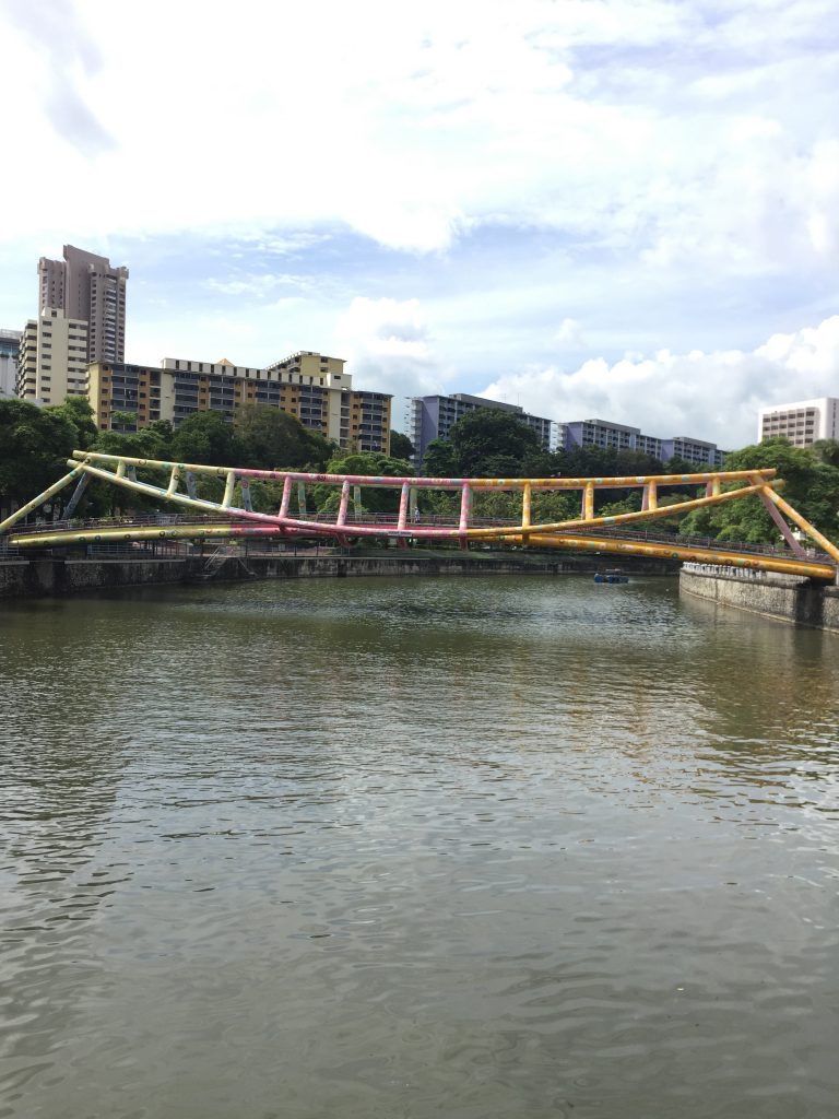
the colourful Alkfaff bridge
And then, there is a little piece of Saigon in Singapore, the Pulau Saigon Bridge. Why the name?
Running this route will take you through 3 party zones and 1 iconic club, Boat Quay, Clarke Quay and Robertson Quay. Each of these have their own flavour and attracts different clienteles. The more upmarket and exclusive will be Robertson Quay. The iconic club is of course Zouk, near Jiak Kim Bridge. This was where I partied in the early 90’s. Zouk has just held its last party in November. This route will take you from the CBD, a hive of business activity, through party zones, high end residential estates and condominiums and finally to Queenstown, Singapore’s first HDB estate. Interesting change of scenery happening within 5 km.
Where does the Singapore River end? It disappeared under Tanglin Road.
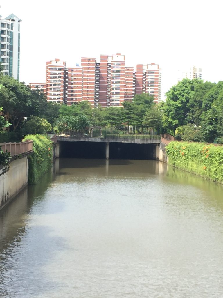
this was where the Singapore River began to disappear – Alexander Park connector
end point crossing Tanglin Road, you will not find the Singapore River.
All told, this route, if you run the full loop is 10km. Its best to run it at a touristy, easy pace during sane hours. You might do a long tempo pace and train your avoid the tourist skills but I suggest any tempo runs here be done in the wee hours before 7am. I coached one of my trainees here and we ran from 6:30-7:30 there when it was deserted.
Getting there, take the train to Esplanade and head towards the Merlion.
What then is my fascination for bridges and rivers? The obvious reasons are aesthetics and history. Running along the river bank is visually pleasing and some of the bridges have beautiful architecture. Because rivers and bridges are the conduits for trade and movement of goods and armies, inevitably rivers and bridges will have history bound to them. Imagining what these histories are and then reading about these interests me.
The not so obvious reason was that on one of my runs along the Seine, I made the connection between the river and value chains. Organisations need to understand their product’s value chain and where they sit in that value chain. Understanding their value chain will help organisation offer value and leverage on their sources of sustainable competitive advantage.
What a wonderful post! That is so chock full of useful information I can’t wait to dig deep and
get started using the resources you have given me.
Your exuberance is refreshing.
Best regards,
Mead Zacho
Very valuable information, it’s not at all sites that we find this, congratulations I
was looking for something like that and found it here.
Best regards,
Harrell Cannon
I would say this is one of the best article I’ve read.
From beginning to end you nailed it totally. To write this
you may have worked hard for research.
King regards,
Dinesen Henneberg
thank you
thanks